Water Resources Projects
Consultancy Services for Construction of Salinity Barrier across Kalu Ganga to Prevent Salinity Intrusion to Kethhena Water Intake
Category
Water Resources Projects
Country
Sri Lanka
Location within country
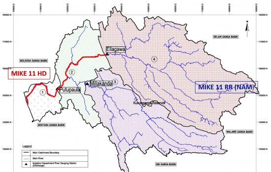
Kaluthara, Kalu River basin, Sri Lanka
Name of client
National Water Supply and Drainage Board, RSC western South
Start/Completion Years
2016-2017
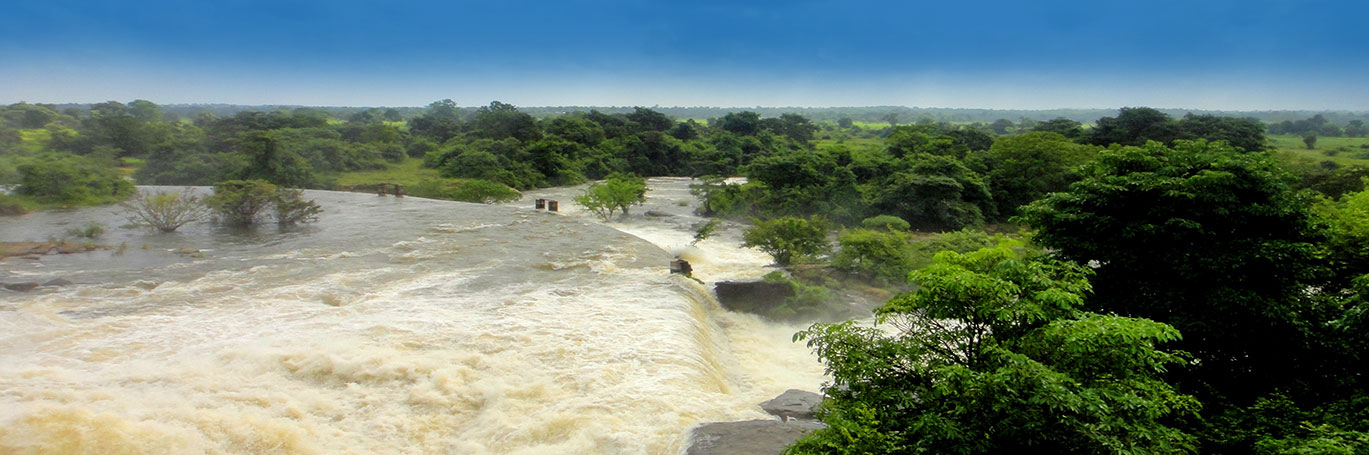
The Kalu Ganga is the main source of potable and industrial water to Colombo South area and coastal belt of Kalutara District from Wadduwa to Aluthgama. There are two water intakes located at Kethhena and Kandana operated under Water Supply and Drainage Board. The Kethhena water intake is located at Kalu Ganga around 17.4 km upstream of the river’s outfall. At present the water extracted from Thebuwana Intake provide the water need of 250,000 people under 60,000 water connections and proposals have been made to expand to serve 540,000 people under 130,000 connections in 2025 in Kalutara District. Salinity intrusion to Thebuwana Intake has become a major problem to National Water Supply and Drainage Board. During the dry weather conditions in the months of February, March and August this intake is badly affected by salinity intrusion which creates severe operational problem of Water Supply Schemes.
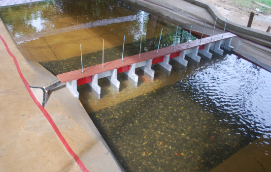
The Kethhena intake is badly affected by salinity intrusion during dry weather period creating operational problems to water supply scheme. As a solution to this major social and health problem, NWS&DB proposed to construct a salinity barrier across Kalu River. It is a requirement to construct a gated automated / manual salinity barrier across Kalu River at the suitable location in upstream of river estuary to control salinity intrusion into Thebuwana Intake.
The scope under the study is to undertake consultancy services to locate the optimum position and design the salinity barrier while minimizing environmental impact of the structure and consequently obtaining the EIA approval paying special attention to Increase of flood levels, Possible adverse water quality occurrence in the upstream pond, Morphological changes with special attention to siltation, Impact on river transport, navigation, fishing, etc, Other environmental impacts, Ensuring minimum environmental flow.
The main project features and scope of work are as follows.
• Data Collection and Desk Study
• Field Investigations (Discharge water level Measurements, Salinity and Water quality measurements, and river bed sediment sampling)
• Hydrological and Hydraulic studies
• Design and cost estimate
• Environmental Impact Assessment (EIA)